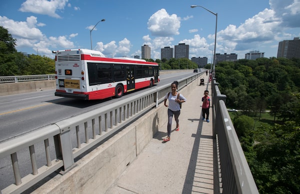
An 81-page report done for the Ontario government offers new specifics about the route the province has suggested for the Ontario Line subway project.Fred Lum/The Globe and Mail
A confidential business case for the proposed Ontario Line subway project in Toronto acknowledges that putting much of the route above ground would have environmental downsides and could inconvenience nearby residents, but notes that tunnelling less would help bring down the cost.
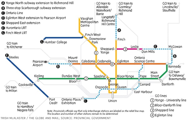
The 81-page report done for the Ontario government offers new specifics about the route the province has suggested, while stressing that it could yet change, with the total number of stations not set. It also provides details of the modelling that underpins ridership forecasts, and makes a case for why the line should end near Exhibition Place, dangling the possibility of a cable car from there to the lake.
Details about the proposed subway line – which Premier Doug Ford has dubbed the “crown jewel” of his Toronto-area transit plan – have been scant since it was unveiled in April. The federal government, which is being urged to contribute billions, has said it received only a two-page summary of the project.
Behind the scenes, officials with Metrolinx, the regional transit agency, and the provincial Crown agency Infrastructure Ontario have been compiling a more detailed business case. The Globe and Mail has obtained the latest version, marked “DRAFT CONFIDENTIAL,” which offers far more granularity than had been known publicly.
The report says the Ontario Line would outperform Toronto’s originally proposed Downtown Relief Line, which it would supersede, in a number of ways. But it emerges against a backdrop of hardening attitudes among some Toronto councillors, who say the city is being dictated to even as it is being asked to foot a hefty part of the bill.
Toronto City Council grills TTC for update on province’s Ontario Line plans
Ontario government to stop funding subsidy for discounted GTA transit fares
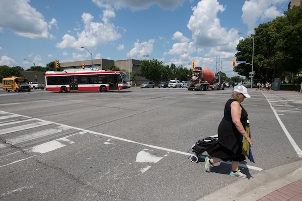
The report says the Ontario Line would outperform Toronto’s originally proposed Downtown Relief Line, which it would supersede, in a number of ways.Fred Lum/The Globe and Mail
“That’s the real dilemma we’re caught in,” said Councillor Mike Colle, a former chair of the Toronto Transit Commission board of governance. “They’re saying, ‘Yeah, we’re building it, we’re making the decisions, and then, by the way, we’re going to send you the bill’. And that is what’s really outrageous about this whole thing.”
Provincial Transportation Minister Caroline Mulroney said Toronto has every reason to contribute to the project.
“It’s a historic subway expansion plan that will benefit transit riders in the city of Toronto and the greater Toronto area, and it’s the kind of project that gets built with the collaboration of the three levels of government,” she said, adding that the business case has been submitted to Ottawa.
“In collaboration with the city, with city staff, you know, we’re going to integrate comments and feedback we get from the people … and try to build something that is actually representative of the needs of the city of Toronto, today and for the future.”
The provincial government is pitching the Ontario Line as a longer, cheaper and more effective relief line. Under the current plan, it would run from the Ex in the southwest of the downtown through the core and then north to Eglinton Avenue and Don Mills Road.
The Globe and Mail
The total distance is projected to be about 16 kilometres, and the total cost, in current dollars, $10.4-billion to $12-billion. It would have 389,000 daily boardings, according to Metrolinx figures, and be ready in 2027.
Although the planned route overlaps relatively little of the relief line, design work for which is 15-per-cent complete, Metrolinx says the Ontario Line could be built on schedule.
The relief line would run 7.5 kilometres, from downtown to the Pape Avenue station on the Bloor-Danforth line, at a cost of $8-billion to $9.2-billion. It would have 206,0000 daily boardings, according to Metrolinx projections, and is promised by 2029.
The report says the Ontario Line would cost less per kilometre because it would not rely as much on tunnels as the relief line, which would be entirely underground. The projected higher ridership of the Ontario Line reflects in part its greater length but also the assessment of the ridership modellers that the deep stations of the relief line might attract fewer riders than the shallower or surface stations the province proposes.
While the report makes the case for the Ontario Line as a better option than the relief line, some of its comparisons are not apples-to-apples.
When it looks at capacity, for example, it uses two different figures for people per square metre for the number of passengers the Ontario Line could carry. It uses only one of these figures – the less crowded one – to calculate relief-line capacity.
The calculations have other idiosyncrasies, some of which affect the analysis of both lines. The report uses a catchment area of 800 metres around stations to project the number of people who might walk to them. It assumes that this distance would take the average person 10 minutes, which is 60 per cent faster than the pace the city uses to calculate walking speed.
Earlier maps had indicated which portions of the Ontario Line might be tunnelled, but the business case offers greater detail on the route, particularly at its north end. According to the document, the line would emerge from its tunnel northwest of Pape station, cross the Don Valley on a new bridge and run above Overlea Boulevard and Don Mills Road on a route known as an elevated guideway. Metrolinx says it is too soon to say whether the elevated section would be above the road or to one side.
The business case argues that tunnelling the whole route, as proposed for the original relief line, would have its own environmental impacts, but also acknowledges that the Ontario Line has “a greater potential for disruption” to the environment and people living nearby. It specifically cites the potential for more noise and vibration and the “permanent displacement” of natural features.
The report pledges mitigation strategies are available “that will need to be identified” in future design work.
“Elevated guideways can be built in a way which is environmentally friendly, elevated guideways can be built in a way which is elegant,” said Metrolinx CEO Phil Verster, who argued that running trains above the road is not inherently a bad thing.
“We will come up with designs that will make it compatible with that environment that it’s being built in.”
The report also offers the greatest detail yet on why the government wants the line to end around the Ex: That location would connect with a GO station, be in the vicinity of several event venues and Liberty Village, and offer access to Ontario Place.
“A station at the Exhibition Place site will bring subway service to the doorstep of Ontario Place, and will serve any future large-scale destination attraction,” the report states. “There are a multitude of options to provide a high-quality connection directly to Ontario Place. Many cities … have waterfront destinations linked to subways by automated people mover, cable cars, or other mode.”
 Oliver Moore