
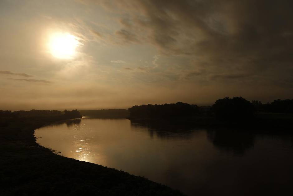
Jacques Courcelles stands, hands on hips, staring down from the top of the west bank of the Red River. It is April and the rust-coloured water is so low it would look like August were it not for the first buds on the ash and Manitoba maple trees on the east side of the river. The bank leading up to the early grass of spring looks like elephant hide, the red clay holding just enough water to glisten. Farther south, over the border into North Dakota and down Interstate 29 to Grand Forks, where so often this time of year the bad news begins, they are already talking drought.
Mr. Courcelles smiles: It’s always something with the Red River.
If there is one thing a Courcelles has learned – Jacques’ own 56 years living on the banks, his parents, Jeanine and Albert farming and raising their family here, his paternal grandparents, Eusebe and Mathilde Courcelles coming out from Quebec in the 1880s to homestead – it is that you never know what the Red will do, so you had better be ready for anything.
Back in 1997, the water spilled out onto the flat Prairie like an open bottle of chocolate milk that had tipped over on the kitchen table. At one point the flood spanned 40 kilometres wide by 75 kilometres long as it spread across southern Manitoba. Damages ran beyond $400-million as 28,000 people were forced to evacuate, leaving behind destroyed and damaged houses, barns and farm machinery. The Courcelles lost not one home but two along the west bank opposite the towering Catholic church.
They called it the Flood of the Century.
The sign welcoming visitors to Ste. Agathe as they turn off Highway 75 says simply, “A Place to Call Home.” Jacques Courcelles had to wonder about that back in 1997 as he faced the reality that his home, like his parents’ home, was lost, the office where he ran his regional health-care business destroyed.
“I live on this river,” he says. “I grew up on it. Eighteen years ago, we had a choice – ‘last one out turn off the lights’ or else start all over again. We chose to start over.”

The Red River is a major Canadian historical figure. Its valley is where the buffalo truly roamed – in 1800 the North American prairies were home to an estimated 50 million bison. It was where First Nations came to meet and trade. It carried voyageurs during the fur trade. The trails along and leading from the river carried the earliest settlers on Red River carts, the squeaking of the big-wheeled vehicles audible long before the travellers came into sight.
It is also a significant political figure. The Red River Colony was where Métis leader Louis Riel set up his provisional government in 1869. It was the means by which Colonel Garnet Wolseley and his men arrived from the new Dominion of Canada to put an end to the Red River Rebellion. Had there been no dispute over who governed the Red River settlements, Manitoba would not have become Canada’s fifth province in 1870.
Those who have previously only seen maps of North America are often surprised to discover that the Red River flows north. It begins, after all, close to where the Mississippi has its source, and the Mississippi flows south; on a geography class wall map, the Red River points “down.”
This was once Lake Agassiz, a glacial landlocked body of water whose total area exceeded the Great Lakes combined. When it gradually disappeared more than 10,000 years ago, it left behind Lakes Winnipeg, Winnipegosis, Manitoba, Lake of the Woods and this usually thin ribbon of a river that runs north from Fargo and Grand Forks to Winnipeg. Here the Red is joined by the Assiniboine River at a confluence known as The Forks before making its way north through Selkirk and a wide delta to Lake Winnipeg.

As the height of land throughout this long journey is barely four metres, flooding comes easily to the Red.
Oral histories among First Nations suggest a flood in 1776 may have been the worst ever, but there are no official records. The river seriously overflows, on average, every 35 years or so.
While each flood is unique, there is a general pattern: A wet fall saturates the ground, severe temperatures before first snow cause a deep frost, lots of snow with little thawing, a late spring, a rapid melt with above-normal rain or snow – or, worst of all, a late-season blizzard.
Officially, the Flood of the Millennium occurred in 1826. George Simpson, the governor of the Hudson’s Bay Company, reported that the Red River settlement (now Winnipeg) was under 3.5 metres of water and that five people had perished, a number he considered a miracle.
“There has been today a peculiar noise,” David Anderson, the bishop of Rupert’s Land, noted in his diary that spring, “like the sound of many waters, such as one may imagine the distant sound of Niagara: it was the pouring of water over the plains.”
People had been killed; the settlers had lost livestock and buildings. They fled the worst of it and yet, as the bishop and his fleeing congregation reached the northern delta, Mr. Anderson noted “violets and buttercups, raspberry and strawberry blossoms were grateful to the eye.”
Such optimism in the face of destruction is the signature of the First Nations, Métis, Scottish and French who long ago declared the Red River Valley “A Place to Call Home.”
The bishop moved about by canoe – sometimes hoisting a sail – to visit his people and thought dawn looked like “a sunrise at sea.” He noted the trees still standing were in blossom, their branches filled with songbirds. With the water receding, he took quill and ink to diary and calmly noted, “now the melody of former times may be renewed.”
He may have been the first to declare this hopeful attitude, but he would be far from the last.
Before the French such as the Courcelles of Ste. Agathe arrived, the European settlers mostly came from Scotland, the most resilient among them the Highlanders following their chief, Lord Selkirk, to a new land where they could escape the English who, following the disastrous Battle of Culloden, had set out to destroy the ancient clan system.
The Scottish Lord bought vast shares in the Hudson’s Bay Company when the fur trade was crushed during the Napoleonic Wars. His interest wasn’t furs but territory for his people.
The first group came across in 1811, using the northern route into Hudson Bay and landing where York Factory sits today. They spent the winter encamped in the freezing cold and in the summer of 1812 paddled 1,200 kilometres upstream to reach The Forks.
They arrived without plows to work the ground. They came at a time of great tensions between the Hudson’s Bay Company and the North West Company over the remnants of the fur trade and were caught in several clashes with the traders and natives. They were attacked and several were killed. A plague destroyed their crops in 1837 and, by extension, would have destroyed the coming year’s crop as well had two men not walked 1,600 kilometres south until they were able to purchase enough seed to save their settlement.
“No body of settlers in Canada ever endured more prolonged or terrifying suffering than did the Selkirk people,” novelist and fellow Scot Hugh MacLennan wrote.
Perhaps they stayed because they felt they had no choice, having no home to which they might return. But this does not explain those who followed, and who chose to stay on. These people simply learned to live with a river that, every generation or so, would turn on them with a vengeance.
It was only after the great flood of 1950 – when costs ran to $100-million and the army had to come in and help 100,000 Manitobans flee their homes – that serious efforts began at controlling the Red.
Following the recommendations of a royal commission, the provincial premier of the day, Duff Roblin, managed to get then prime minister John Diefenbaker to agree to share the enormous costs of building a floodway that could protect the city of Winnipeg. Smaller communities along the Red began building dykes – Ste. Agathe, much to its regret, thinking such drastic measures unnecessary – and rural residents took to rebuilding on higher ground created by bulldozers and fill.
The floodway plan was to build a channel 48 kilometres long around the city where, when the spring runoff reached a certain level, excess water from the Red could be diverted safely around outlying neighbourhoods and rejoin the bed of the river as it headed north.
Work began in 1962 and was finished in 1968. It was costly, $63-million for the first phase, and upsetting to those people who had to be uprooted. More than 100 million cubic yards of earth were removed, nearly a third more than that required for the dredging of the St. Lawrence Seaway.
Derisively, people referred to it as “Duff’s Ditch,” a monumental folly that would never prove necessary. How wrong they were: Once the floodway was ready for use in 1969, it would be used nine of the next 11 years.
In 2006, when the Red River again flooded, Bill Rannie of the University of Winnipeg’s geography department told The Globe and Mail that, in his opinion, without the floodway Winnipeg “would have had to be completely evacuated in 1997 – it would have been a New Orleans [following Hurricane Katrina].”
According to the provincial government, the floodway has prevented some $40-billion in damages since it was built. After 1997, a decision was taken to expand the system further.
R.S. “Bud” Oliver served as mayor of Selkirk between 1983 and 2002. Now 78 and retired, he looks back on a lifetime dedicated to bringing the various stakeholders – North Dakota, Minnesota, Manitoba, rural municipalities and cities – together to deal with the drainage of the Red River basin as one integrated group.
“Duff’s Ditch was the saviour of Winnipeg,” Mr. Oliver says. “That was not a term of endearment you know when they first dug it. The cost was huge and there was a huge upheaval of people. But in ’69, after the first time it had to be used, well, then it was the best idea in the world.”

There is a saying in North Dakota that “You can see Sunday company coming on Thursday afternoon.” The sky is overwhelming, the horizon forever.
The drive down the interstate to Grand Forks is about as varied as the path of a plumb line. Cruise controls set to the 75-mile-an-hour limit, cars are heavily outnumbered by the truck traffic between the American heartland and Canadian breadbasket. The only distractions are the radio and roadkill.
At Grand Forks, there stands an obelisk high on the banks of the Red River that splits Grand Forks, N.D., from East Grand Forks in Minnesota and passes under the Sorlie Memorial Bridge, erected in 1929 and still standing. The brown stone obelisk reaches for the sky, ascending rings noting where the water rose to in 1996, 1882, 1979, 1897 and – two thick rings higher still – 1997. Here in Grand Forks is where the Flood of the Century did its most damage.
“The water came right up to here,” says Barry Wilfahrt, tapping high on the entrance to the Chamber of Commerce building on North 3rd Street, well back of where the Red River passes this day.
Mr. Wilfahrt is the president and CEO of the chamber that covers both Grand Forks communities on each side of the river. Such cooperation was not always so cozy, as North Dakota entered the Union in 1889 as a “dry” state and, somewhat consequently, East Grand Forks in Minnesota thrived as a wild frontier town with more than 40 saloons and multiple bordellos.
What brought the two communities together, more than anything else, was disaster, and none more so than the Flood of the Century 18 years back.
It had been a vicious winter, with no less than eight blizzards striking the area and roughly three metres of snow falling. They were already dealing with flood conditions when Hannah hit on April 4, 1997. An ice storm covered everything and then came wet, heavy snowfall followed by high winds, freezing and collapsing trees and power lines. More than 100,000 were without power.
The floodwater rose so quickly and so high that much of the two small cities had been evacuated when at 4:15 p.m. fire broke out in the downtown Security Building on the North Dakota side.
The battle was on. Firefighters were trying to rescue those who had refused to go by pushing through freezing waters more than a metre high. Fire trucks heading downtown to deal with the spreading blaze stalled in the water. Fire hydrants, submerged under water, lost their pressure.
They called in the army to help. Planes and helicopters dropped fire retardant. After two desperate days, the blaze was brought under control, but by then 11 buildings over two city blocks had been lost.
The Grand Forks Herald won a Pulitzer Prize for its coverage of the floods, despite the fact that the Herald offices were lost in the fire. Mike Jacobs was editor at the time and self-deprecatingly says, “It must have been a slow news month. The prize was the gift of the river – it was just such a fantastic story.”
Mr. Jacobs set up temporary quarters in nearby Grafton. They printed in another town. At one point, he says, a rumour spread that the river had altered its course and was now coming directly through Grand Forks and would destroy everything. When the rumour turned false, he says, “Everything changed. We faced up to the loss then because we thought we had lost everything. That helped us enormously to battle back.”
The recovery was long and difficult. The Red Cross came to help; volunteers poured in from all over North America. Those who had homes to return to had no power, no water. It took more than three weeks to restore drinking water. It would take years to recover, but today downtown Grand Forks and East Grand Forks on the other side of the Red are rebuilt and thriving.
As Winnipeg did after 1950, the two Grand Forks and communities farther upstream, such as Fargo, have worked to ensure a repeat of 1997 never again happens.
The Red River, however, remains a threat even when the water runs as low as it has through the spring of 2015. This was Dust Bowl country during the Great Depression. There were summers when the Red River ran dry.
“All we hear about is the flooding,” Mr. Wilfahrt says, “but there is also the threat of drought.”
And yet, the population of both communities has grown since 1997, just as they grew following the flood on 1979.
When the floodwater of ’97 had receded, Mike Jacobs penned a piece for his paper entitled “Tell Me Again Why We Live Here.”
Mr. Jacobs and his family had been out of their home for 43 days. His paper’s building had been lost in the fire. And yet the Jacobs, like everyone else, never considered leaving.
“There’s just something compelling about the landscape,” the retired newspaper editor says today. “It’s unusual because of its immensity – immensity without end, the flatness goes on forever. If you stand up, you stand out.”

Jacques and Nadine Courcelles had an idea. If the people of Ste. Agathe were determined to stay by the river that had all but destroyed their little town, the people should know more about the river and its often erratic behaviour.
With his father, Albert, who died last summer, and a team of volunteers, Mr. Courcelles set to work building an interpretive centre on the edge of town. The people of Ste. Agathe would build it in a park and not only would it become a tourist attraction but an educational tool. Nadine and other volunteers would bring in schools from all along the Red River Valley, and the children of tomorrow would grow up more aware of their unpredictable river than any generation that had gone before.
Today, the Red River Valley Floods Interpretive Centre sits in a small park on the edge of town named after George Etienne-Cartier, who was once the area’s Member of Parliament. The volunteers planted 6,000 trees, built a swimming hole, set out plots for summer campers and constructed a large building that would tell an interactive tale of the Red River Valley floods.
The centre sits directly across from an industrial area called Riel Park, named after the first elected member for the riding of Provencher, Louis Riel. The local hero was voted in but never allowed to take his seat in Parliament, leading to the parachuting in of Cartier. But that is another story for another time….
The Ste. Agathe volunteers estimate they have spent about $1.4-million in total, mostly raised through grants, but that tally would not include their labour. The working notion, says Mr. Courcelles, is that “natural disaster happen everywhere. We need to be better prepared and we need to be better at predicting and mitigating effect.”
Approximately 1,000 schoolchildren a year go through the centre. They study photographs and family diaries and twist through a long series of displays that tells how floods occur and what happened during the area’s most severe flooding.
There is a great deal of drama but also a touch of humour. “It’s been quite an experience, all right,” Edna Forrester, wife of Emerson mayor Walter Forrester, said after staying on in their home through the 1950 flood. “I’m getting sick of wearing heavy wool socks and hip waders.”
The history of the dyke construction around the various communities is told, including how Ste. Agathe elected not to when others were building walls of protection and later came to regret that decision.
“WATER TORTURE,” screams the front page of the April 30, 1997, edition of the Calgary Sun.
Torture, yes, but life follows. In fact, the very reason that the Red River Valley is considered one of the world’s most fertile areas is tied directly to the bed of ancient Lake Agassiz and the ebb and flow of the Red River itself.
“My father farmed here for 50 years,” Mr. Courcelles says. “And he believed that every time there was a flood event, he would have a great crop.”
After the horrific 1997 flood and the incredible losses of Ste. Agathe, it seemed sensible to reconsider. The people had to be evacuated by the Canadian army in the middle of the night, and yet at the first opportunity they were back cleaning up.
“We weren’t going to give up without a fight,” says Mr. Courcelles.
And that, really, is the story of the Red River Valley.
“We stay and deal with it because we are Red River people,” says Bud Oliver, the former mayor of Selkirk. “Everybody has a choice of where they want to live. And those who stay do whatever is necessary to be able to stay.”
Jacques Courcelles stops outside the door of the Ste. Agathe Interpretative Centre. There is still much work to be done. The swimming hole needs a liner. The kitchen has yet to be completed. The facilities for holding weddings and family reunions are unfinished.
“It enters the sphere of thunderous stupidity,” Mr. Courcelles says with a smile. “Sometimes you say, ‘What was I thinking?’ but it’s about believing in your community. Sometimes, you know, you have to think beyond your lifetime.”