In an age before satellite surveillance, planes were the only method of gathering photographic intelligence on enemy defences and troop locations. The photos show everything from German bunkers guarding the beaches of Normandy to the progress of Allied troops in the wake of D-Day, 68 years ago today. Browse these photos from World War II by hovering over each image. You can also read the full story and get a step-by-step walk through of the Pegasus Bridge photo.
Hover over each photo to zoom in and see more detail.
The Pegasus Bridge
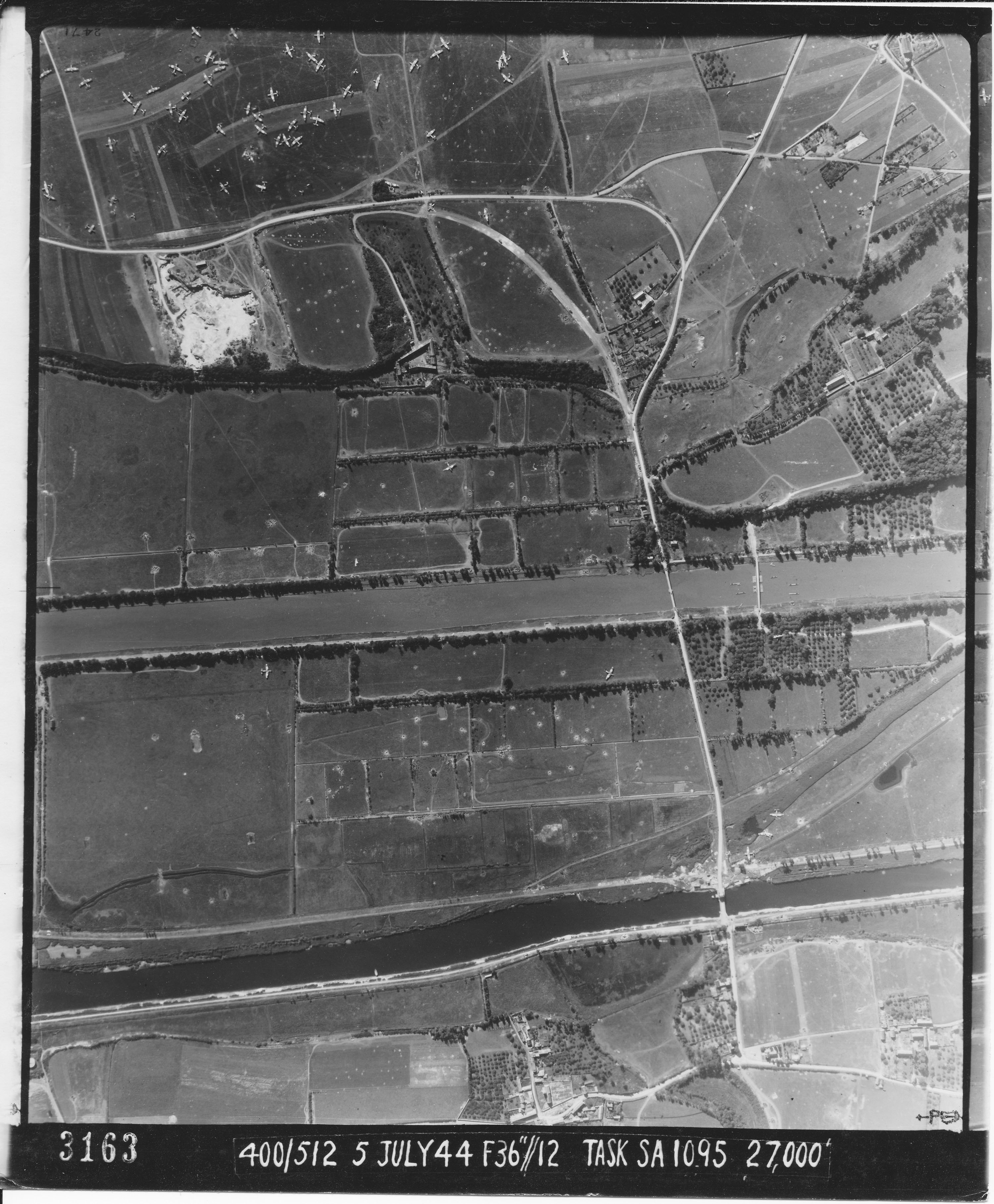
Pegasus Bridge and surrounding area shown about a month after D-Day. The gliders that brought the troops to capture the bridge (near the bottom of the photo) are visible nearby; this was the opening battle of D-Day. At the time this photo was taken, it was still close to the front lines. Fox holes and other earthworks for protecting tanks and vehicles are visible in the fields near the centre of the photo. Mouse over Horsa bridge, above Pegasus in the photo, and you can see a convoy of vehicles crossing.
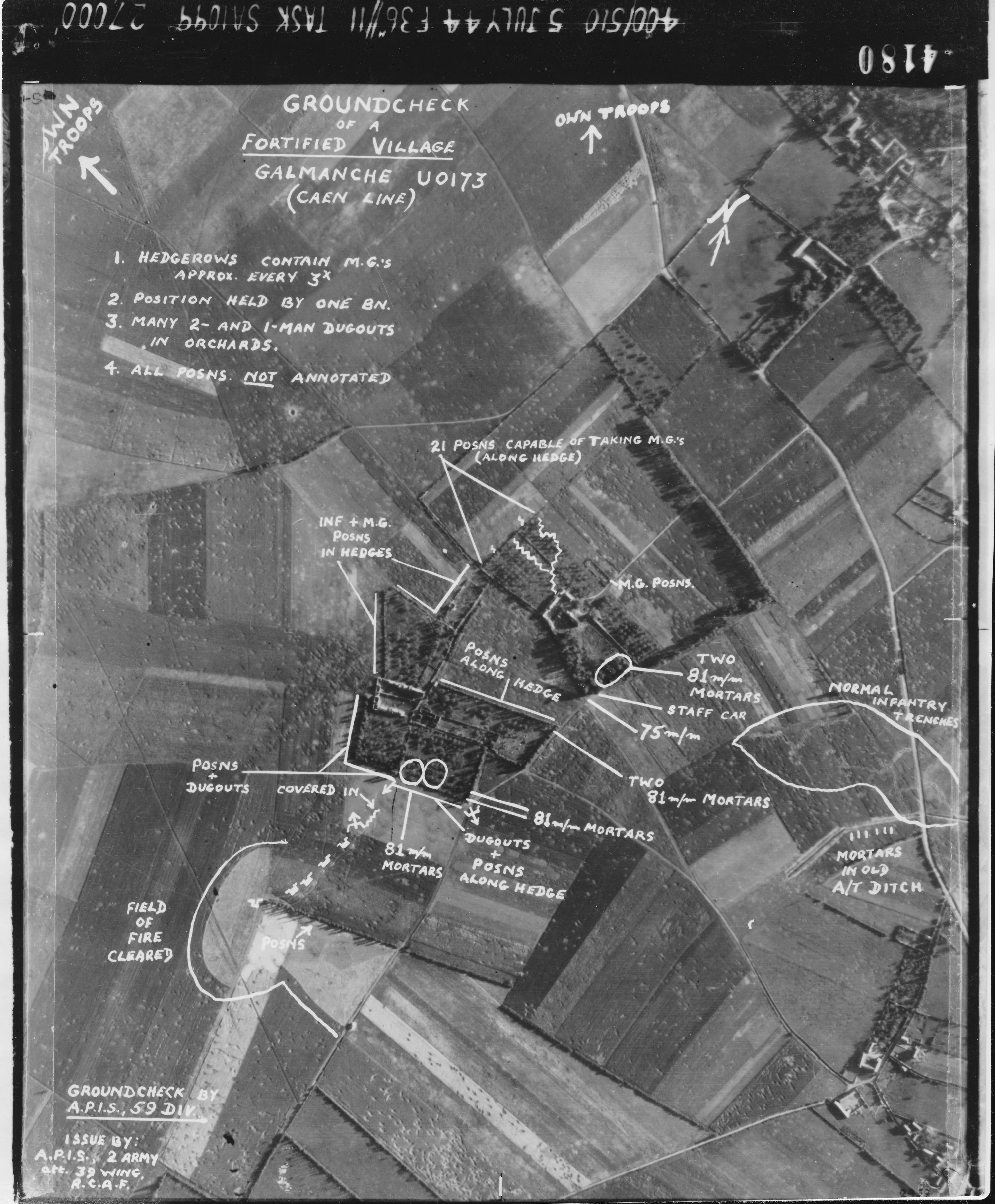
A view of the fortified village of Galmanche, near Caen, with the various defences – including mortar positions, trenches and dugouts – marked.
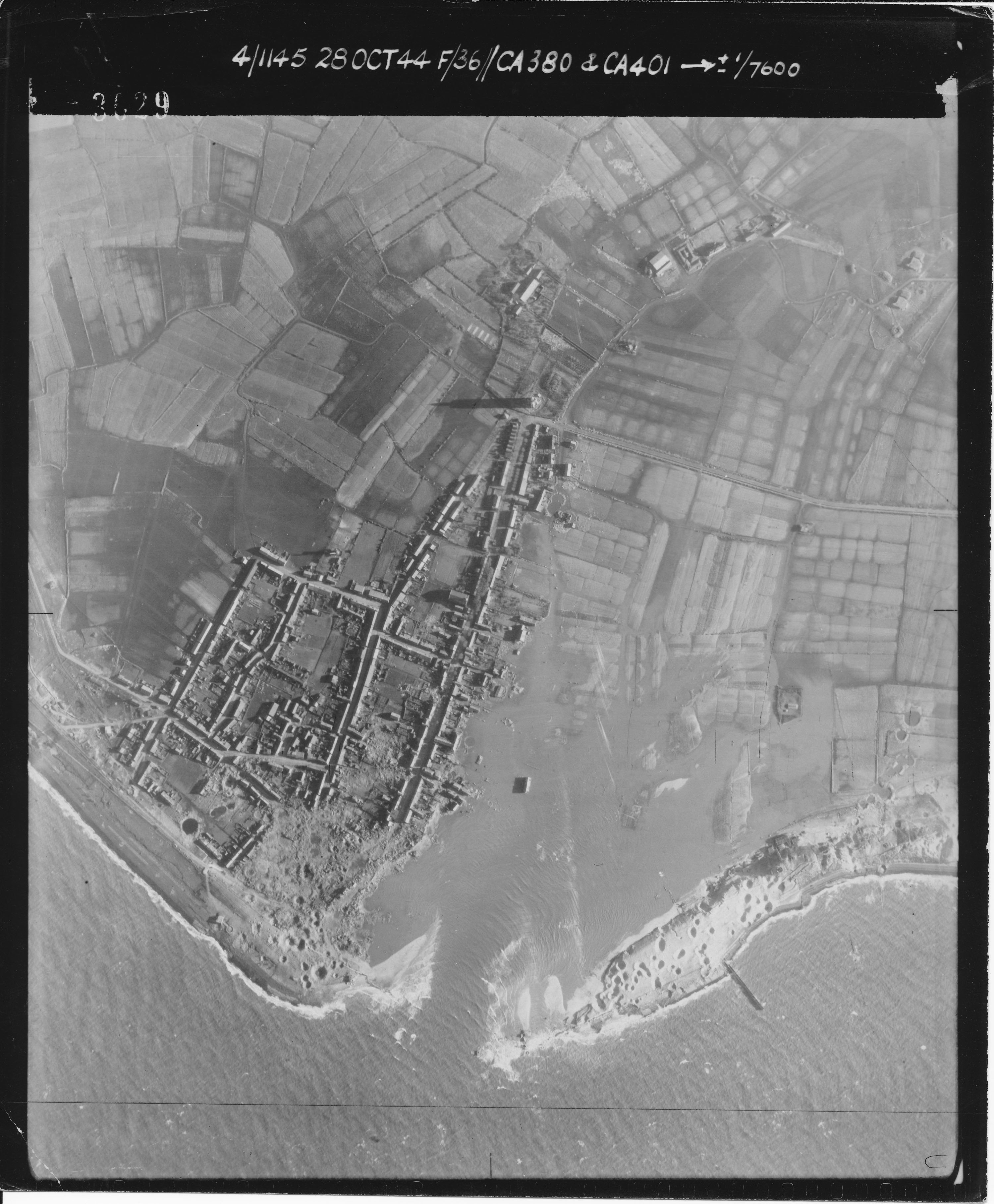
The Dutch town of Westkapelle. In October, 1944, the Allies bombed nearby dykes to flood out the Germans, putting part of the town underwater.
Le Fresne Camilly airfield, near the Normandy Beaches.
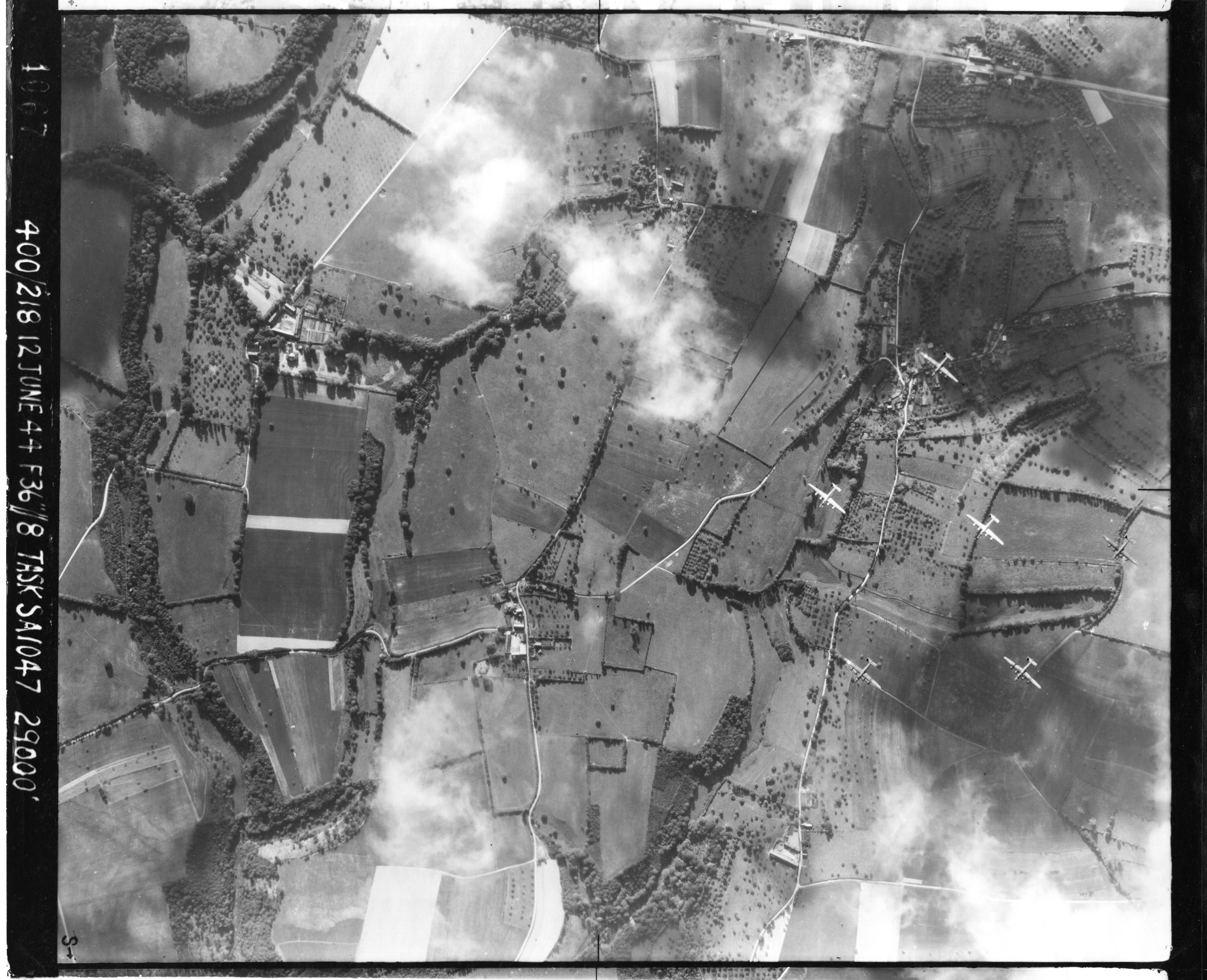
A group of B-24 bombers flying over France shortly after the Normandy invasion.
Omaha Beach, the American landing point, in August of 1944. Boats and routes for bringing supplies inland are visible.

Bayeux Cathedral in July 1944. The city was one of the first places to be liberated after D-Day.

A German bunker on Juno Beach, near the village of Courseulles-sur-Mer, shortly before D-Day. On the left side of the photo is the village, look closely enough near the edge of the image and you can see what appear to be two human figures walking down the street. To the right side of the photo are two smaller covered bunkers and barbed wire. In front of the larger, main bunker in the centre is a concrete wall. This sheltered it from naval gunfire, but allowed defenders to shoot from the sides at soldiers on the beach. This would prove deadly effective on D-Day: the Canadian unit that captured this area lost all but 27 of its members.

An aerial view of a bombing run in progress at Mont Lambert, France. Capturing the village was an important objective for Canadian forces as they struggled to take control of the port of Boulogne in September, 1944.
